The reed beds in the upper sections of the estuary above Tal-y-Cafn bridge have been designated as an SSSI due to their sensitive habitat and wildlife.
Please do not deliberately canoe through or get out in the reed beds.
DISTANCE: 15 km of tidal estuary from Conwy to Dolgarrog.
LOCATION OF START AND FINISH: Start and finish are both on the WEST side of the Afon Conwy. TRANSPORT: As this is an A to B event, you are advised to organise your own bank support team/car ferrying arrangements between the start and the finish. ACCESS: There is no access/egress to or from the river other than at the start, the finish and at approximately halfway at Tal-y-Cafn bridge. At Tal-y-Cafn there is an access point on the EAST bank, immediately upstream of the bridge. PORTAGES: There are no portages unless you hit a sand bank or reach Tal-y-Cafn rapid before the tide. TOILETS: Portaloos are available in the start car park.
|
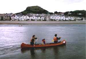
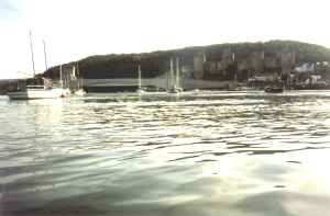
From the start at Deganwy Narrows the course goes for 2km through Conwy harbour, continuing on past the castle and under the bridges. | |
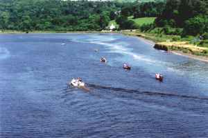
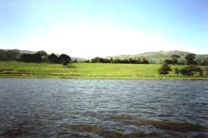
| After that the estuary opens out to about 1.5km wide and you head up to Cymryd Point which you leave on your right after 1.5km. You then cross to the east bank and follow the bank round until the estuary straightens out and starts to narrow down. At the end of this straight the estuary has narrowed to about 300m wide and you cross back as it bends round to the right. | ||
|
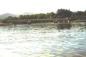
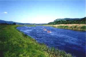
The estuary then narrows down to about 150m wide and you see the steel girder Tal-y-Cafn bridge ahead. This is just over halfway at 9km. | |
| About 300m above the bridge the river bends round to the left and then fairly sharply back to the right under some woods causing back-eddies on the inside of the bend. 400m further on, just before a white cottage on your right, there is some turbulence in the water caused by underwater rock ledges. This is Tal-y-Cafn rapid, and if you have set off too early you may have to portage the boat up this! | ||
|
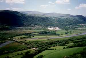
The estuary then widens out again for the next 2km, before narrowing back down to about 50m wide with reed beds on the banks for the last 2.5km to the finish which is under another steel girder bridge at Dolgarrog. | |
| Site of Special Scientific Interest (SSSI): The reed beds in the upper sections of the estuary above Tal-y-Cafn bridge have been designated as an SSSI due to their sensitive habitat and wildlife. Please do not deliberately canoe through or get out in the reed beds. |
|
|
|
||